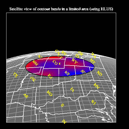
ContourPlot example 17


This example shows how to do a combination of things: restrict a
contour plot to a certain area over a satellite projection, how to
label the US states with AnnoManager, how to use
NhlDataPoly{line,marker} to draw lines/markers on a map projection,
and how to mix LLUs/HLUs to draw text in the map projection. The NCL
version doesn't have the LLU/HLU part. The names of the example codes
that create this plot are cn17c.c, cn17f.f, and cn17n.ncl.
Discussion
Some of the resources are controlled through a resource file called cn17.res.
A detailed discussion about how to create the plot appears in the
comments of the source code for the example.
The HLU C program that generates this plot is
called cn17c.c.
The HLU FORTRAN program that generates this plot is
called cn17f.f.
The NCL script that generates this plot is called cn17n.ncl. Please note that
the NCL version only has one frame (the HLU C and FORTRAN versions
have two frames) because you cannot call the LLUs from NCL.
The dummy data for this plot is generated from within the program.
The examples are installed in the following locations:
- $NCARG_LIB/ncarg/hluex/contourplot/cn17c.c
- $NCARG_LIB/ncarg/hluex/contourplot/cn17f.f
- $NCARG_LIB/ncarg/nclex/contourplot/cn17n.ncl
The resource file for this example is located in:
- $NCARG_LIB/ncarg/resfiles/contourplot/cn17.res
You can copy this example and run it by typing "ng4ex cn17c", "ng4ex
cn17f", or "ng4ex cn17n". A copy of the source file and resource file
will be placed in your current working directory. The source code
will be compiled and automatically run for you.
Quick Start Guide Control Panel
NG4.1 Home, Index, Examples, Glossary, Feedback, QSG Contents, QSG WhereAmI?
$Revision: 1.4 $ $Date: 1999/03/23 18:34:20 $